29. I'll have to admit that I really didn't expect this snowfall to actually happen. Yeah, it showed up in the models since last week, and the HPC highlighted the Western Great Lakes, but after all this warm weather?
The last time I had snow on the ground was March 21st, forty-nine days ago. I was hoping we were finished with winter.
The NWS forecast a swath of snow across Minnesota, Wisconsin, and Michigan. This image is a screenshot I grabbed from the NWS Office in Duluth on the 7th (Friday). Winter Weather Advisories were issued Friday afternoon for the areas that were forecast to receive the heaviest snowfall.
While the ground and roadways were above freezing, roadways were reported as "slippery" overnight.
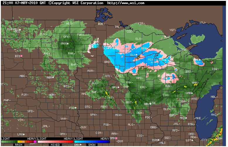
From Intellicast.com I grabbed a screenshot of the regional radar last night at 21:00 CDT.
The color they use to denote snow (blue) and mixed precipitation (pink) is not always accurate. Snow began falling eight hours earlier across northern Wisconsin, while this image shows the snow is only beginning.
This demonstrates how important ground truthing really is. Observations from webcams, automatic weather stations at airports, and spotters provide invaluable information from what is actually happening at ground level (not thousands of feet up in the atmosphere).
As of this writing on Saturday morning, the highest snowfall report in Wisconsin comes in from the high terrain of the snowbelt (go figure).
Gile in Iron county reports 6 inches of snow on elevated surfaces (colder than the warmer ground) and 4 inches on grassy surfaces.Other reports have come in from around the region, as far south as Portage and Waupaca counties.
The highest total in the region, so far, is Baraga County in the UP of Michigan at 7.6 inches total. A Winter Storm Warning was issued for a central portion of the UP overnight. Lake Superior seems to have added some moisture to the system.
I found 1.2 inches of snow on my elevated snowboard this morning. A little less than 1 inch accumulated on the grass.
The rain from yesterday, combined with the snow, produced 0.40" of liquid precipitation in the last twenty-four hours. It's been a very long time since we've received that much liquid in one day.
Looking back over the last few years, Maple Hill on the Bayfield Peninsula usually sees winter's last snowflakes the third week of April.
Records go back much farther in Duluth, MN.
10 May 1902, Duluth recorded 5.5 inches of snow. 8 May 1924, Duluth recorded 5 inches. 27 May 1932, Duluth recorded 2 inches.
There are eleven reports of measurable snow in May at Duluth, since 1902.

 From Intellicast.com I grabbed a screenshot of the regional radar last night at 21:00 CDT.
 As of this writing on Saturday morning, the highest snowfall report in Wisconsin comes in from the high terrain of the snowbelt (go figure).


